Geotechnical Investigation using Cone Penetration Testing (CPT)
Tyndall AFB Project Site
ATI Geologica completed twenty-five (25) Cone Penetration Tests to depths ranging from 15 ft and 60 ft. The tests were performed using a track-mounted Geoprobe 7730DT anchored in soil using two helical anchors and on concrete and asphalt using drop-in anchors and bolts. An electronic piezocone manufactured by Vertek was advanced at a rate of approximately 2 cm/s (0.8 in/s). The data was recorded using the Vertek DataPack and their proprietary software, CPTSND. The data was then processed using Vertek’s Coneplot to obtain the raw data and basic graphs and tables.
This Factual report summarizes the results of the cone penetration testing, including highlights and a more comprehensive evaluation of the results using GeoLogismiki CPeT-IT, a proprietary software written in collaboration with Dr. Peter K. Robertson. The CPeT-IT software has the advantage of being able to combine similar soil layers and produce a summary table of soil properties for these layers. No warranty is provided on the interpretations given by the GeoLogismiki software and the results are provided for reference purposes only.
Twenty-five CPTs were performed to depths of between 10 and 60 feet below ground level (ft bgl). SW-09 hit early refusal at 10.07 ft bgl in suspected building rubble and was moved 12 ft northwest to SW-09A. LS-02 refused early at 19.83 ft bgl in a dense material. The hole was repushed with added anchorage the following day using the same hole but advancing to 51.56 ft bgl. Dissipation tests were performed in three soundings (SW-03, SW-09 and SW-11).
Each sounding ran continuously without disturbance or interruption and the data collected is considered to be accurate and representative of each respective location.
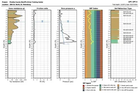
Following please find two CPTU profiles created by data presentation an interpretation software. These reports were created on December 12, 2022.
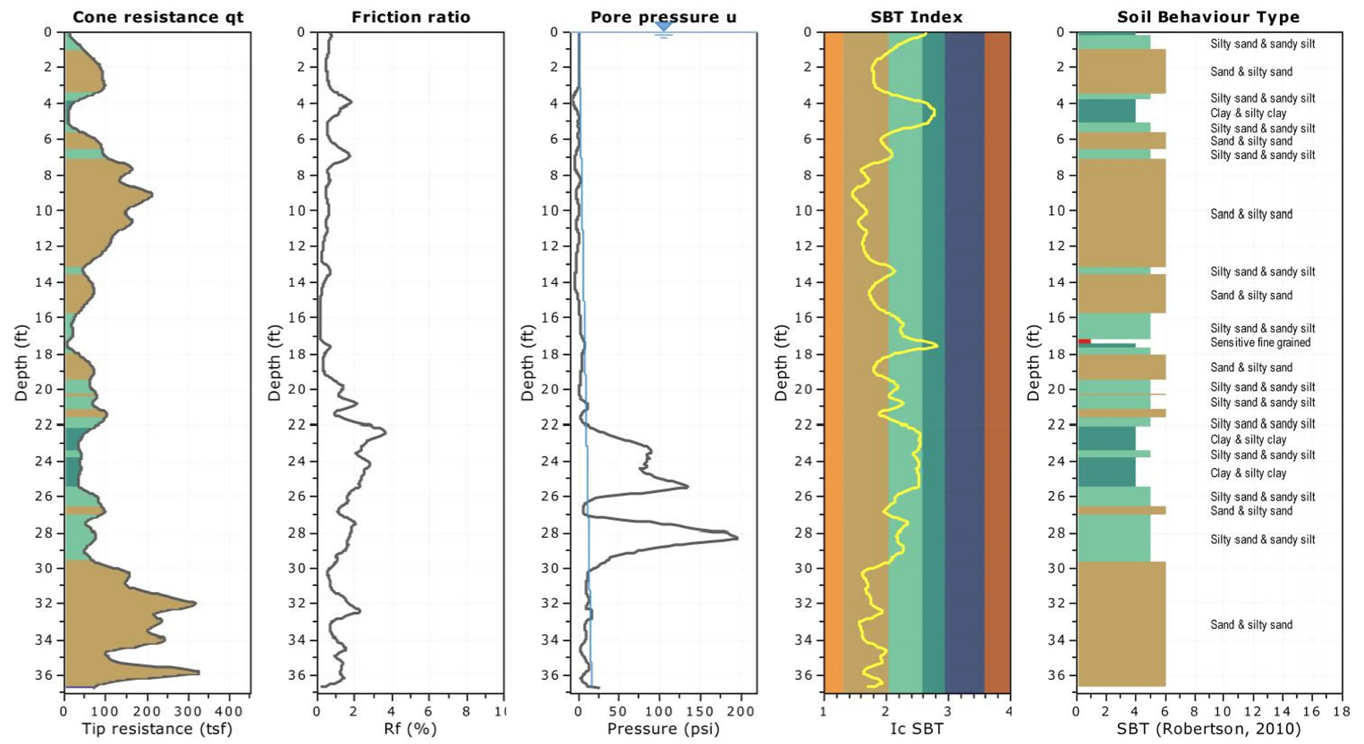
The materials presented mainly as mixes of sands, silty sands and sandy silts with rare clayey layers. Low tip resistance in C-01 between 4.607 ft and 6.067 ft bgl caused negative qc readings to be recorded within that section and hence no soil type is shown on the Soil Behavior Type (SBT) plot between those respective depths.
The groundwater levels (GWL) were measured when possible and recorded. The GWL depths were entered manually on all the sounding profiles. The water table was not measured on five of the soundings due to the holes closing after retracting the rods, this was the case in running sands.
Client Contact: Cody Wallace, P.E. - ECS FLORIDA, LLC - email: CWallace1@ecslimited.com Tel: (850) 354.5725. Address: Florida